Hey everyone, if you’ve ever stared at a weather map and noticed those tight lines marking where temperatures shift fast—like a 10-degree drop between a valley and a hill just a mile apart—you’ve seen a temperature gradient in action. I’m Jake, part of the team here at our meteorological instruments supplier, and I get way too geeked out talking about how we measure these things. Most folks just know a thermometer tells you the current temp, but measuring gradients (the rate temp changes over distance or time) is a whole different ballgame—especially when it’s not just a backyard setup, but stuff we ship to farms, airports, climate researchers, and even mountain weather stations. Let’s break this down like we’re hanging out at a coffee shop, no stuffy jargon unless we need it. Meteorological Instruments

First off, let’s get real about why this matters, because you might be thinking, “Who cares if the temp changes a little over a mile?” Wait till you’re a corn farmer watching a frost roll in—one side of your field might be 5 degrees warmer, and if you don’t catch that gradient, you lose your crop. Or a skier chasing powder; a 2-degree gradient at 8,000 ft vs. 9,500 ft could mean the difference between light, fluffy snow and slush. Even city planners use gradient data to figure out where heat islands are worst (like downtown vs. a park 2 miles away). This isn’t just weather nerd stuff—it’s how people make real decisions every day.
Now, how do we actually measure a temperature gradient? Let’s start with the most basic (but often messed up) mistake people make: you can’t use a single thermometer. That’s like using one phone to map cell service across a city—it’s not enough. You need two or more sensors spaced at specific intervals, right? But the interval matters. If you’re measuring a gradient over 100 yards for a small garden, you don’t need two sensors 5 miles apart. We usually tell clients to space them based on what they’re tracking: for microgradients (like a roof vs. the ground), 1–5 feet apart works. For larger, regional gradients, maybe a few miles or more.
Wait, but not all temperature sensors are made equal here. A mercury thermometer? Nope, way too slow. If one’s reading 70 degrees and the other 65, but the sensor takes 2 minutes to update, you’re getting a wrong gradient because the temp changed in between. That’s why we use what’s called RTDs (Resistance Temperature Detectors) and thermocouples—these are the workhorses of our instruments, and we sell a ton of both. Let’s keep it simple: RTDs are super accurate (like ±0.1 degrees) and stable, perfect for stationary setups that need consistent data. Thermocouples are fast—they react in milliseconds—so if you’re measuring a gradient that shifts quick, like during a cold front rolling through, thermocouples are the way to go.
Here’s a trick most suppliers won’t tell you: it’s not just spacing the sensors—it’s making sure they’re exactly the same model, calibrated to the same standard. If one sensor is off by 0.3 degrees and the other is off by 0.5, your gradient calculation is going to be wrong. Calibration is non-negotiable, and we do that at our shop before every shipment—we test each sensor against a NIST-traceable standard, so clients don’t have to stress about that. That’s a big reason folks come back to us; we don’t just box up random sensors, we make sure the whole setup talks to each other correctly.
But wait, what about when you need to measure a gradient over time too? Like, how fast the temp drops as a cold air mass moves down a mountain. That’s a temporal gradient, different from the spatial one (distance). So you need a data logger that’s synced to all your sensors, recording at the same interval. We sell loggers that can hook up to 8, 16, even 32 sensors at once—great for mountain weather stations where you have sensors at the base, middle, and summit. A lot of our mountain clients use these because a 20-degree gradient between base and summit in 2 hours isn’t unheard of, and missing that means they can’t issue avalanche warnings or trail alerts.
Let’s talk about a common problem we run into: interference from the environment. If you stick a sensor in direct sunlight, it’s going to read 5–10 degrees warmer than the actual air temp—called solar radiation error. That’s garbage data, and it’s the #1 mistake new clients make when setting up their own gradient stations. So what do we do about it? We sell radiation shields (we call them “fans” sometimes, but no, not the box fans—small, ventilated shields that block sun and rain) that let air flow through but keep direct light off the sensor. Also, we tell clients not to put sensors near concrete or asphalt, because those surfaces hold heat and mess with readings. Last year, a local landscaping company bought a basic sensor set and complained their gradient data was way off—turns out they put one sensor on a black driveway and the other in the grass 10 feet away. We swapped their driveway sensor for one with a shield and moved it to the shade, and their data was spot on within a week.
Another cool tool we offer for gradient work is a thermocouple array—like a strip of 10 tiny thermocouples spaced 6 inches apart, all on a single cable. That’s perfect for things like measuring temp gradients in a vineyard, where each row is a little different. You can stretch the cable across 50 feet of vines and get 10 data points at once, instead of setting up two separate sensors. Our arrays are lightweight too—great for hikers or researchers who need to carry gear into remote spots. We also have wireless options now, so you don’t have to run cables through a field or up a mountain. The wireless transmitters send sensor data every second straight to a phone app, so clients can check the gradient in real time. A lot of our construction clients use these for large projects, like building a highway, where temperature gradients affect how concrete cures—you have to get the temp just right, or the concrete cracks.
Wait, let’s not forget about airborne measurements? No, that’s not drones, though we work with drone pilots too—wait, no, profilers. We sell atmospheric temperature profilers that use a vertical array of sensors mounted on a tall tower, like 100 ft or higher. That measures the gradient from the ground up to 100 ft, which is super important for air quality studies (like how pollutants mix at different heights) and wind energy (turbines at 300 ft care a lot about temp gradients that affect wind shear). A few months back, we shipped a profiler to a wind farm in Texas—they needed the data to adjust their turbine settings when temp gradients shifted overnight, which improved their energy output by 7%. That’s the kind of impact this stuff has, not just number-crunching.
Let’s get into the math part, but keep it simple. The temperature gradient is just the change in temp (ΔT) divided by the change in distance (Δx). So if Sensor A reads 60 degrees at point 0, and Sensor B reads 50 degrees at point 1 mile away, that’s a gradient of -10 degrees per mile. If it’s over time, it’s ΔT divided by Δt—like a 5-degree drop in 30 minutes is a gradient of -10 degrees per hour. But here’s the catch: you have to account for any lag in the sensors. If Sensor A updates every 10 seconds and Sensor B updates every 5, the data timestamps are off, so your ΔT calculation is wrong. That’s why our loggers sync all sensors to a single clock—no lag, no messy math. We even have software that auto-calculates the gradient for you, so clients don’t have to do it manually. No more Excel spreadsheets with mistakes, that’s a win in my book.
Wait, what about extreme environments? We ship a lot of gear to places like the Arctic, or the Sahara, where temps swing 50 degrees in a day. We make sure all our sensors are rated for those temps—our RTDs work from -100 degrees F to 300 degrees F, no problem. A few years back, a research team in Antarctica bought a gradient setup, and they said the sensors worked perfectly even when it was -70 degrees outside. That’s the stuff we care about—our gear doesn’t quit when the weather gets nuts.
Let’s talk about common myths, because I hear these all the time. Myth #1: “You just need two thermometers.” No, like we said, calibrated, spaced correctly, and you have to make sure they’re not in different microclimates. Putting one in the shade and one in the sun isn’t two thermometers for gradient work—it’s two thermometers measuring different things. Myth #2: “Gradient is the same everywhere at the same time.” Nope. Gradients shift with the time of day—during the night, cold air sinks, so you’ll see a big gradient between a low field and a hill, but during the day, the sun mixes the air, so the gradient is almost zero. That’s why you need continuous data, not just a one-time reading.
At our shop, we’re not just selling instruments—we’re helping people solve problems. A lot of first-time clients come to us and don’t know exactly what setup they need. We don’t just push the most expensive gear; we ask them what they’re measuring, how far apart, what environment, if they need real-time data, and then build a custom setup. Last month, a small brewery needed temp gradient data for their fermentation tanks—they thought they needed a big industrial setup, but we put together a tiny array of three RTDs that fit on their tank racks, and it was half the cost of what they were looking at. That’s the kind of service we care about, not just making a sale.
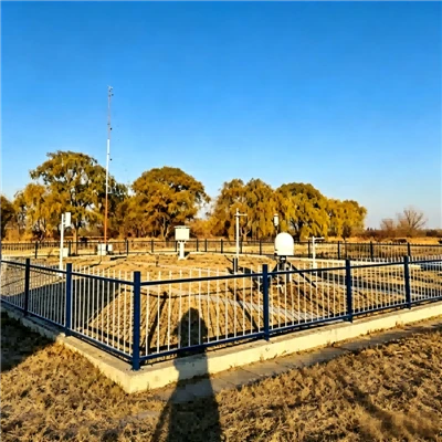
So if you’re reading this and you need to measure temperature gradients—whether you’re a farmer, a researcher, a builder, or someone just curious—don’t mess around with cheap, uncalibrated sensors. The right setup makes all the difference, and we’ve been doing this long enough to know what works. If you have questions, want to chat about a custom setup, or just need help figuring out which sensors are right for your project, hit us up to connect and talk through your needs. We’re here to help you get accurate data, no hassle.
Meteorological Sounding System References:
- World Meteorological Organization. (2020). Guide to Meteorological Instruments and Methods of Observation.
- National Oceanic and Atmospheric Administration. (2022). Temperature Gradient Measurement and Applications in Atmospheric Science.
- American Meteorological Society. (2021). Glossary of Meteorology: Temperature Gradient.
- NOAA. (2019). Best Practices for Air Temperature Sensor Placement and Calibration.
- International Organization for Standardization. (2018). ISO 17025: General Requirements for the Competence of Testing and Calibration Laboratories.
Tianjin Blooming Technology Ltd.
We are one of the most professional meteorological instruments manufacturers and suppliers in China, also support customized service. With abundant experience, we warmly welcome you to buy durable meteorological instruments for sale here from our factory. For price consultation, contact us.
Address: Main Building, No. 10 Wuhua Road, Huayuan Industrial Zone, Binhai High-tech Zone, Tianjin, China
E-mail: sales@blooming-tech.com
WebSite: https://www.blooming-tech.net/
